I frequently see long and acrid online forum argument threads about the superiority of digital charting vs. paper charts. However, like with most things there is no single correct answer for every situation. Can you be all-digital and be safe? Yes! Can you go all-paper and be safe? Yes!
But why do you have to go all one way or the other? Just like sailboats equipped with powerful diesel engines, most of us choose to have both. There is nothing finer than a long sail when the wind is right, the sails are trimmed and the boat is gliding silently across the bay. But when it comes time to work my way in or out of a fuel dock or a marina, I prefer to do it under power. Could I instead sail up to the dock? Sure, in an emergency — but why does it have to be one or the other?
I feel the same way about nautical charting. I like to have the chartplotter running when offshore, silently keeping a continuous note of our position, speed, progress and relation to hazards. But at the same time, I like to have a folded paper chart nearby showing me the big picture at a glance so I can think more broadly about the route, where we are headed, possibly how to deal with an upcoming wind shift, etc.
Scale matters
This one small example indicates one of the major downfalls of most digital charting systems: Due to the available screen size, you can either look at a small area in good detail or a large area with insufficient detail. You simply need more real estate than most chartplotters provide in order to get the big picture with decent detail. Are bigger screens and monitors available? Yes, they are, but I have yet to see a pleasure boat equipped with one 3-by-4 feet, which is near the size of a typical chart.
There is nothing quite like spreading out the big paper chart to plan your offshore route to Bermuda and beyond. Without scrolling or zooming you can see everything from the East Coast out to the islands, including the route of the Gulf Stream, which is critical to your planning. I keep some older charts around the house so I can draw up planned passages or even just summer cruises. A little bit of planning can make a cruise so much more enjoyable.
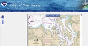
On the other hand, using digital charts on my home PC is a fantastic asset for making those same plans. I can look up any harbor I want to in the USA for free using NOAA's online chart viewer , or I can use one of several charting programs that can utilize the free chart downloads from NOAA (http://www.charts.noaa.gov/). OpenCPN is one of the free navigation programs, and there are versions for most operating systems (http://opencpn.org/ocpn/).
I find the PC charting program invaluable for picking out waypoints, which I like to do prior to being underway, and together with my big paper chart they make for a great planning tool.
Get the big picture of a small harbor
Another area where I like to have a paper chart handy is when approaching a tricky harbor. Yes, the chartplotter can be great in providing detailed views of every place you might visit, but again that view will be centered around where your boat is located. While winding your way up a narrow channel with side channel offshoots, rocks to dodge and possibly funky buoyage, it is great to once again be able to hold a paper chart that provides a bigger picture of everything coming up. Not only can you see the red nun coming up, but you can spot that water tower shown on the chart that creates a perfect range for homing in on the town wharf hidden behind all the boats.
The same applies in the Intracoastal Waterway. Use the digital charting to keep track of where you are and use the paper charts or a chartbook to plan ahead for the next anchorage or fuel stop. It is far easier to flip back and forth through a paper chartbook than it is to scroll up and down the electronic screen.
The more tools the better
When I am repairing something on board it often saves time and money in the long run to go out and purchase the right tool for the job. The same applies with paper charts and digital charts. Have both available and use the best tool for the job at hand.