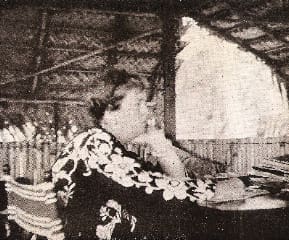
The term “eccentric” is often applied to the adventures of Mary Sheridan Fahnestock. She joined her two sons on a sailing adventure to the South Pacific and wrote about it in her book, titled I Ran Away to Sea at Fifty. In previous issues, we have written about the adventures of Bruce and Sheridan Fahnestock who made two passages to the South Pacific before World War II, the first aboard the schooner Director, a 59-foot former Portland, Maine, pilot boat. It was during this passage that their mother Mary joined them. The brothers, along with Dennis Puleston, whom we wrote about previously, departed New York City on New Year’s Eve 1934 bound for a cruise around the world. The past two navigation problems in Ocean Navigator were based on their voyages. Now it is Mary’s turn to have her say.
In the late 1930s, a 50-year-old woman who was also a grandmother and a widow was considered a senior citizen. So it took some self confidence to get from New York to California and thence on to Tahiti in order to meet and sail with her sons in the South Pacific.
Mary was married to the inventor Adam Fahnestock and raised three children. The family lived well in Long Island and the children were raised with a strong sense of independence and self reliance. The boys became excellent sailors and winning racers. While still in college, they decided that what they wanted to do was sail around the world and their parents supported the plan. The family was distantly related to the director of the American Museum of Natural History and Sheridan and Bruce established a scientific agenda with the museum that would help them pay for the voyage.
Right before the boys left New York, their father died, leaving the family in chaos. With their mother’s encouragement, however, the boys sailed as planned. (See Stars to windward, Issue 200, May/June 2012). When they finally arrived in Tahiti they mailed their mother a letter, asking her to join them on their South Seas expedition.
From that experience, she wrote a story that takes her past the grief of losing her husband to joining in an adventure that was unparalleled as she sailed in the south seas. Indeed the South Pacific before World War II was little changed from the place that Gauguin had run away to or that Jack London or Robert Lousi Stevenson had known and loved. It was still an adventure in paradise where there was little direct communication with the mainland.
Mary’s adventure is a tale from another time, but one that gives a window into the interactions between two devoted sons and their strong-willed mother who had enough sense to let her children be and yet raised them to be confident, good people.
Let’s join Director in the South Pacific. It is May 21 and we will use the 2012 Nautical Almanac. The vessel is on its way from the Marquesas to Samoa. The DR at the time of the noon sight is S 10° 30’ by W 150° 10’. We have a height of eye of 15 feet and no index error. We are doing a lower limb shot of the sun, which was the method most often employed by the Fahnestock brothers while aboard Director. The Hs of the sun at LAN is 59° 03.4’.
A. Calculate the time of LAN in GMT at the DR position.
B. Reduce Hs to Ho.
C. Calculate the latitude.
Answers
A. Time of LAN at DR in GMT is 21:57:40
B. Ho is 59° 15.0’
C. Latitude is S 10° 20.7’
Long Answer
“I Ran Away to Sea at Fifty.”
by David Berson
Once again we reinforce the most basic and yet most important celestial navigation technique-that of the noon sight. I have heard so much nay-saying from off-shore sailors about why celestial navigation is no longer appropriate that I have to laugh. I want to say “just wait until all your systems crap out or you get a lightning strike and you have no electronics. See where you are at then.” But I hold my tongue knowing that you readers out there believe as I do, that celestial can be an ace in the hole. So we have the tried and true technique of ascertaining latitude from a shot of the sun at noon. As we know LAN is dependent upon the longitude of the observer so the first thing we have to do is find out at what time the sun will pass over our meridian. We do this by converting Arc to time. In this case we are at a DR of 10° 25’ S by 150° 10’ W. We need to do everything in GMT so we have to covert our DR longitude to time. In other words I am asking: How long does it take the sun to travel from the Greenwich Meridian west to 150° 10’? From the tables in the NA we see that it takes the sun 10 hours to travel 150° and another 40 sec. to travel the remaining 10’ of arc. As always with celestial try not to confuse the minutes and seconds of time with the degrees minutes of arc. To find the time in GMT for Meridian Passage we need to go to the daily pages of May 21 and find the time of Mer. Pass at the bottom and we see that for the 21st the time in LMT is 11:57. To this we add the 10 hours 40 sec and we get the time in GMT for LAN at:
Mer Pass 11:57
150° 10 hrs
10’ arc 40 sec
Mer pass in GMT 21:57: 40
A bit before that time, at 21:55:10, we shoot the sun and see that it is at its peak with an Hs 59° 04.3’. We have a height of eye of 15 feet and no index error. We need to reduce the Hs to Ho by introducing the dip correction and the corrections for refraction, semi-diameter and parallax. This is SOP:
Hs 59° 03.4
-dip 3.8
Ha 58° 59.6’
+ 3rd corr 15.4’
Ho 59° 15.0’
Next we plug the numbers into the formula Latitude = 90°-Ho=Zenith Distance(co-Altitude)=/- declination so we do the following
90° 00’
-HO 59° 15’
ZD(co-Alt) 30° 45’
In order to complete the process we need to know the declination at the time of the observation. We go to the daily sun pages for May 21 and see that the dec. of the sun at 21 hours is N 20° 23.8’ with a d corr of .5’. By inspection we see that the declination is increasing — as it should be until the solstice — and since our time of the sight was almost at 22 hours I choose to use 22 hours declination which is 20° 24.3’ Now I have to subtract this from the ZD(co-Alt) in order to find my latitude so we have:
ZD(co-Alt) 30° 45’
-Dec 20° 24.3
Latitude N 10° 20.7’
If there are any questions, comment below or e-mail a request to Ocean Navigator to do a navigation seminar so we can all get together and create and solve problems. Have fun!