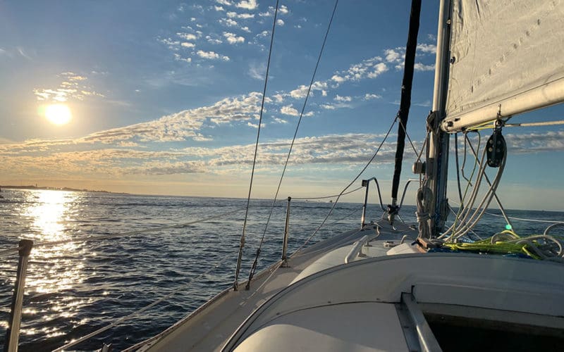
Navigation is fundamentally about discovering the rules that govern nature. Unlocking these secrets is one of the most gratifying aspects of sailing; from observing the physics of weather to revealing our position relative to the celestial bodies. Another one of the most rewarding elements of navigation is understanding the tides. And tide considerations became central to the planning of a recent 60-nm passage I made in late summer of 2020 from the Great South Bay on Long Island to New York Harbor.
Tides express themselves in two distinct but subtly interrelated ways: vertically through tidal height and horizontally through tidal currents. Too often, these aspects are erroneously conflated. The high and low tides of the oceans do not equal slack tide in waterways, as many sailors casually assume. The relationship between them is complex and can have a significant effect on coastal passages in tidal waters, especially when crossing inlets.
Tides are caused by the lunar and solar gravitational pull on one side of the earth and an inertial bulge on the other. Depending on the declination of the moon and orientation of the sun, these effects are exaggerated during the spring tides and diminished during neap tides.
These gravitational and inertial forces, however, are not the sole determinant of the tides. As the earth rotates, the continents impede the westward flow of the tidal bulge as it circles the earth. Additionally, the geographical and topographical particularities of continental coastlines further complicate the movement of the oceans. This ultimately results in diurnal, semidiurnal and mixed semidiurnal cycles. In some places, like the Gulf of Mexico, high water and low water occur only once a day. On the other hand, the Solent in the U.K. is notorious for its “double high water” due to the intricate network of converging and constricted waterways that focus the flow of the ocean.
Shifting shoals
For the passage I made last year from Great South Bay to New York Harbor, I needed to dive into the tide data and make some decisions. My route would take me from Great South Bay out through Fire Island Inlet into the Atlantic, along the Long Island shore, and then finally into Far Rockaway Inlet. Long Island extends more than 100 nm from Montauk at its eastern point to New York Harbor at its western end. The southern shore consists of a series of long barrier islands that separate the North Atlantic Ocean from the inland waterways, the most prominent of which is the Great South Bay. There is only a single practically navigable inlet between Great South Bay and the Atlantic: Fire Island Inlet. It is subject to shifting shoals and strong tidal currents that require a careful understanding of the tidal dynamics to safely navigate.
As I would be making the passage in my 45-year-old International Folkboat, Sparrow, a 26-foot full-keeled sloop, almost exclusively under sail (with only a truly auxiliary single-cylinder diesel of the same vintage aboard), the crux of the planning was based on timing the transit through the narrow Fire Island Inlet and taking advantage of any tidal currents.
The principal goal of the passage-planning exercise was then to determine the ideal date and time to transit Fire Island Inlet, considering the strong tidal currents, prevailing winds, and daylight hours. I began by studying the NOAA charts that encompassed my route. One particularly useful symbol that is conspicuously absent from all NOAA charts is the tidal diamond, which indicates the set and speed of tidal currents (or tidal streams, as our British cousins refer to them). It is telling to note that these symbols are incorporated into all British Admiralty charts, which are published by the UKHO (United Kingdom Hydrographic Office, the British equivalent to NOAA), which was founded in 1795 by arguably the most storied and nautically dominant nation in history. Without such useful information graphically integrated into the NOAA charts, I turned to the most valuable resource referenced during my passage planning: Tidal Current Tables: Atlantic Coast of North America, published by NOAA and available for any region in North America.
Before delving into the tidal dynamics of the inlet, however, I consulted the climatological data and descriptions of the NOAA U.S. Coast Pilot. This confirmed my local knowledge that the prevailing winds were from the south and southwest during the summer months, especially around September when I was generally targeting a departure date. After conferring with the local Coast Guard station and fellow mariners with local knowledge, I established that the most significant danger lay in transiting Fire Island Inlet. In the inlet, the outgoing tide, which many mariners would intuitively assume would be ideal to ride out with, would counter the prevailing southerly winds and create erratic and dangerous cross-sea conditions. Instead, the only viable time to pass through the inlet would be at slack tide. Additionally, I needed to consider how best to sail in under the flood tide when arriving at the Rockaway Inlet at the entrance of New York Harbor, the location of my home mooring.
Tidal/sunlight matrix
Considering these various factors, to identify the ideal departure date I created a comparative matrix that correlated sunrise and daylight hours with the earliest occurring slack tide. The best date would be where the sunrise occurred nearest to slack tide, so that I could safely pass through the inlet as early as possible and maximize daylight hours under sail.
The data was largely derived from the Tidal Current Tables, which list figures based on major reference stations to more concisely catalog the large quantities of data for all minor stations. For this passage, The Narrows was the reference station for Fire Island Inlet. I then populated the matrix with data for sunrise and sunset, the resulting daylight hours (to maximize sail time) and the flood tide range for Coney Island (to time the Rockaway Inlet arrival). I did this for the three-week period I was contemplating a departure date.
The data was analyzed by color-coding the values and comparing slack tide times at Fire Island Inlet to the maximum daylight hours, assuming a slack tide departure. There were at least three favorable departure dates, so another variable was compared to further narrow the options. When I compared these dates to the flood tide times at my destination, it became evident only one date range was ideal over the three-week period: September 4 to 7. This would allow maximum daylight hours under sail, with slack tide occurring closest to sunrise and an incoming flood tide during arrival at my destination.
This comparative methodology paid off when my brother and I steadily transited Fire Island Inlet under full sail and a gentle breeze shortly after sunrise on September 5. After a sunny sail along the southern coast of Long Island, we took the flood tide in at the Rockaway Inlet and arrived at our mooring before sunset. This passage-planning exercise was a humble reminder that often the most basic and seemingly simple elements of navigation can also be the most gratifying. n
Sharif Khalje works in NYC at an architectural firm.