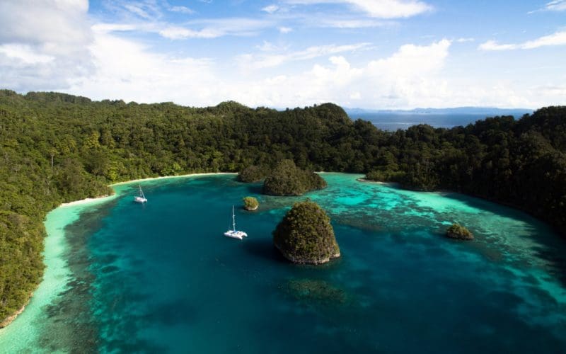
Matt and Jennifer TenEick and their sons Conrad and Mark voyage aboard their 1992 Privilege 482 catamaran, Perry. Both Matt and Jennifer grew up in the Chicago area, learning to sail on Lake Michigan. The two followed similar career paths, each starting in law and then switching to the tech industry. Since they both love to travel, the idea of cruising the world on a boat began to take shape for them. It started out as a five-year plan to be in a position to buy a boat and leave. But, in the end — due to careers, kids, economic implosions, and a million other small things — the departure date stretched further and further. Ultimately, it became a 10+ year “plan” before they finally quit their jobs in 2012, sold their house and almost everything in it, and bought their boat, Perry. Going on nine years of full-time cruising later, they currently find themselves in the Maldives, after having spent a “pause” year stuck in Galle, Sri Lanka, due to COVID.

OV: How do you approach the subject of safety? Has your experience sailing offshore affected your thinking on safety?
M&JT: Wow. That’s such a simple question but is so broad and has so many complexities depending on what level of detail you drill down to. Safety for us is not really a separate subject but one that really overlays almost all of our decisions with regards to cruising. At a high level, safety concerns helped formulate our decisions on what boat to buy and how to outfit it. It also drives our decisions on long-term route planning as far as what areas to be in during what seasons. At a mid-level of granularity, safety concerns impact our decisions on which specific weather windows to take, what repairs take precedence over others, and how to stock the boat with appropriate spares and medical supplies. At a very detailed level, safety impacts how we run the boat on a day-to-day basis and derive rules such as never being on the foredeck without an observer present, or what our reefing strategies are, or when to tack, or where to anchor.
Of course, safety is always a trade-off with other important considerations as well. To provide a concrete example, we, in part, used safety to justify the extra expense of purchasing a catamaran that had, among other aspects, two engines. Having a vessel with an “extra engine” allowed us to continue to function when we hit a huge log in West Papua, Indonesia, that bent our strut and knocked one engine off its mounts. We were in the middle of nowhere from a major boat repair standpoint but were able to safely make the several-hundred-mile trip to Darwin in Australia to make repairs.
Part of our “approach” to safety is probably driven by our previous work life. Both Jen and I are attorneys by training, and we then worked in IT project management. Both fields tend to train you to always consider “worst case scenarios” and ways to mitigate risk. So the ability to move forward on any task while keeping in mind the possible bad outcomes is just the way we’re used to running our lives. That makes us sound really fun at parties, doesn’t it? Of course, knowing what the “worst case scenario” can be is a bit of a challenge and one of the reasons we’re always trying to expand our knowledge and understanding of how situations can devolve from mere inconvenience into major catastrophes.
Before sailing, we enjoyed wilderness backpacking and dabbled a bit into mountain climbing, taking a week-long course that laid out the barest basics of mountaineering and staying safe in an alpine environment. The course had some reading prerequisites, among which were “as many as you can read” of “Accidents in North American Mountaineering,” the annual book published by the American Alpine Club that documents and analyzes the hundred or so accidents that occur each year. The rationale was that the more examples you had to draw on about how circumstances evolve and can go downhill, the better prepared you will be to identify a dangerous situation in your own adventures. It’s a great rationale that carries over into the sailing world and one that drives people (us included) to understand just how a boat was abandoned or a life was lost, even though it sometimes feels like gawking at a car crash. We want to know the details not out of morbid curiosity, but so we can avoid becoming our own worst-case scenario.
Jen also has her private pilot’s license, and when she was flying would have that same curiosity about how air accidents came about. The psychology behind some of the pilot errors can be really interesting and there are sailing parallels in how you can get disoriented at night or in low visibility. The sailing world would probably benefit from a similar roundup of sailing accidents each year. Hey, ON, I’ve got an idea for you….
Offshore sailing just drives home the importance of taking safety seriously. There are plenty of times when we are the only people around for hundreds of miles, and there is no one else to depend on if something goes sideways. It’s at those times (and planning for those times) that really makes us take safety seriously.
OV: How does voyaging with children affect your safety planning?
M&JT: When we first started cruising, the kids were only four and five years old. We purposely decided not to sail off until they were old enough where we could at least hold a semblance of a conversation with them and be able to tell them “do this” or “don’t do this” to certain things and have them (sort of) understand. We didn’t need netting or car seats to confine them. Our decision to voyage with young children helped shaped our decision process for selecting a boat. We really liked the fact that our boat has a well-defined cockpit area (as opposed to the more modern “open stern” style in fashion now) that made it easier to “confine” the kids and set easy limits on where they were allowed to be. As the kids have gotten older and more knowledgeable about sailing, it’s easier to trust that they will make good decisions, but teenage impulse control and a firm belief in their own indestructibility still presents challenges!
ON: What planning do you do for a possible medical emergency? Did you receive any medical training before you began voyaging?
M&JT: Medical emergencies are one of the major concerns, especially on longer passages or in remote areas. Like lightning, there’s a certain unpredictability to medical emergencies: you can be doing everything right, and yet it just hits you, and you’re left to deal with it as best as possible.
We try never to leave on an extended passage (more than a couple of days) unless everyone is feeling healthy and well. We delayed a passage from Fiji to NZ for a bit while Jen recovered from a relatively minor skin infection just to ensure that the infection didn’t take a turn for the worse and we’d be left to deal with a sepsis situation while underway. We keep a full complement of all the “usual” medications on board. Prior to leaving, we sat down with a good doctor friend of ours and developed a list of the most common/beneficial medications and equipment to have on board. Since our visits to the South Pacific, Solomon Islands, and Papua New Guinea, we have added a lot more antibiotics because those waters seemed to breed skin infections. We also have suture kits, IV equipment, and some of the modern blood clotting beads used by the military to stop major bleeding from wounds. Luckily, we’ve never had to use any of this equipment, but it’s nice to know it’s available (for us or others) if required.
We both have a bit of basic first aid training. I was a Boy Scout, Jen’s mother is a nurse, and we are lucky to have a number of friends and family connected to the medical field, so we both have a very basic understanding of first aid and diagnosing probable illnesses. We keep copies of the Ships Captain Medical Guide and Where There Are No Doctors on board, and they are both good resources to help figure out and treat conditions that aren’t immediately obvious. We also view our satellite phone as a piece of medical safety equipment. If something happened where we needed immediate access to advanced medical knowledge, the sat phone can provide that gateway. We also maintain DAN membership to have evacuation insurance for really serious issues.
ON: What type of life raft do you have?
M&JT: We have a valise style, six-person Ocean Safety brand life raft. It sits in a rear lazarette that is accessible from both the cockpit as well as from the underside of the bridge deck. However, we’re firm believers in the old saying, “always ensure you are stepping UP into a life raft.” We’ve seen so many examples where crew abandon a boat they thought was doomed only to have the boat be discovered relatively intact sometime later. But I do realize that it’s easy to say that now, when the boat hasn’t been rolled, or the rudder snapped in atrocious conditions, or whatever other chain of events has led one to consider abandoning ship. I just hope we have the presence of mind to rationally consider the situation if it ever presents itself to us.
ON: What do you have in your abandon ship bag?
M&JT: The ditch bag is a 40-liter dry bag. It contains:
4 Mylar material “survival suits”
Fishing kit (line, hooks, sinker)
Signal mirror
Strobe light
Swiss army knife
Folding-blade serrated knife
Safety whistle
20 meters parachute cord, carabiner on one end
4 chemical light sticks
Waterproof matches
Photocopies of passports, ships papers
$100 bill
3 Power Bars (only one chocolate, though. Going to be fighting over who gets that versus the Oatmeal Raisin)
First Aid Kit
Sunscreen
3 foldable, very light sunhats
2 hooded ponchos
1 emergency blanket
Laminated card on the outside to remind us to grab: sat phone, EPIRB, flares, water jugs, VHF handheld, wallet, iPad, foul weather gear, extra flashlight. Card also has USCG emergency numbers on it.
ON: Do you have an EPIRB, PLB, or a tracking/messaging device like an InReach or SPOT?
M&JT: We have an ACR EPIRB unit that will auto-deploy if the boat sinks. We initially had a single PLB for the overnight watch stander but did not replace it once the battery went dead. If we were to get personal locators, we would purchase the AIS type, since chances are there will be no one around anyway to act upon a message sent via satellite to a remote command center. Better to allow those remaining on the boat to have an accurate fix on the MOB to allow for a self-rescue.
ON: Do you actively use radar for collision avoidance?
M&JT: We typically don’t rely on the radar for collision avoidance, as it seems like the areas we sail through typically have very little traffic, and AIS (see below) is more effective. The small benefit of the radar being constantly on is outweighed by the drain on the batteries. We actually went the first couple of years without radar, but it was a few experiences with bad squalls overnight that finally pushed us over the edge into purchasing radar. We typically use the radar to check for squalls and to help avoid them if we see one coming. The added warning time the radar gives is a huge benefit, and it makes the difference between an easy, controlled reef in 15 knots versus a hurried and wet reef with 30-knot winds pinning the main up.
And we do enjoy having the radar for vessel tracking and avoidance as well at times. Radar is useful for keeping track of the small and mid-sized fishing boats that seem to never have AIS and whose zig-zagging random course changes always seem to target you at the last minute.
ON: Do you have an AIS unit on board?
M&JT: Absolutely! AIS is one of the best safety tools that you can invest in to ensure collision avoidance. I think all boats should be equipped with both transmit and receive AIS capabilities. We have a Vesper Marine Watchmate unit, and we love the fact that it draws so little power that it can remain on 24x7x365 (going on nine years of cruising, it has only been turned off about five times). It also has its own screen and a very intuitive graphic showing the closest point of approach. We can easily know an hour in advance if an approaching ship is going to present an issue. And if you are in a close crossing situation, the transmit function of AIS ensures that you are seen by the big boats who often take matters into their own hands and deviate a few degrees to keep clear of you (not that they are concerned we would make a dent in their vessels, but I’d imagine they are trying to avoid the paperwork, which would be horrendous). And, unlike radar, you can typically see the names of the ships around you, allowing you, if needed, to hail them on VHF by name, rather than some ambiguous coordinates and heading info.
We also use our Watchmate AIS unit for its excellent anchor alarm function. It’s one of the reasons that we chose to go with a standalone unit with a screen. This allows us to only keep the AIS unit on, rather than also running a chartplotter to keep tabs on the anchor location. All in all, if I had to choose between radar or AIS, I’d go with AIS every time.
ON: What types of weather data do you use on your voyage? How do you gather weather information?
M&JT: Before leaving, we typically have internet access and take full advantage of the info that it can provide. We rely heavily on Windy.com and Predictwind.com for basic weather data. We also use some of the NOAA and .mil sites to track cyclone formation probabilities (although if we’ve done everything else right, we shouldn’t be needing those much!). Most of the data we try to interpret obviously revolves around the various wind prediction models. We typically follow the Euro ECMWF model as we’ve found it to be more accurate than the US GFS model. The “enhanced” models that Predictwind provides are usually even more accurate still, so we often look at the “PWE” model. Regardless of the absolute accuracy, we try to leave on forecasts where all of the models are in close agreement, as this is the best indicator of predictable weather patterns.
In addition to the wind data, we also look closely at the CAPE index, which is a measurement of available atmospheric energy for convection — in other words, how likely, and how severe, squalls and thunderstorms can be. If we see large areas of high CAPE values, we may pass on an otherwise good-looking wind forecast. We will also look at Windy.com and RTOFS for current prediction.
Once we are underway, we use our sat phone to download gribs and/or routing advice from Predictwind, usually once a day. The routing data is very small and downloads quickly when compared to a larger grib file. Often we will download just the routing info, and if it has not changed much, we know the overall weather situation has remained pretty stable. If the new routing predictions are considerably different, that means something has changed, and we will spend the time to download the new grib files to get a better sense of the altered bigger picture. Typically, even if things don’t change much, we will still download new gribs every third day.
ON: Do you use a weather routing service?
M&JT: We have only used the Predictwind automated weather routing service. We have not used the paid services of professional weather routers. We do closely follow the blogs and available info put out by those professionals, in an attempt to understand the conditions we will be sailing into and to try and recognize those conditions that we should avoid. Bob McDermott puts out a weekly email that’s great for understanding the larger weather patterns in the South Pacific. Likewise, Chris Parker for the east coast of the U.S. and Caribbean. We have had friends take advice from Des Cason to help them with the tricky passage to South Africa across the Mozambique Channel and Agulhas current. We will probably reach out to Des as that passage draws closer.
We are not against using a weather router per se, but our philosophy is to try and become proficient in whatever we need to be so that we can rely on ourselves. Plus, we have plenty of time to read and study, and only a limited supply of money, so we try to make it work on our own. Of course, one of the main reasons we feel confident about our approach is that we are typically only in areas of the world where the weather patterns are known, reasonably simple, and somewhat predictable. If we were to attempt a winter west-to-east crossing of the Atlantic, you can be certain that we’d hire a good router!
ON: What are your future voyaging plans?
M&JT: After being stuck in Galle, Sri Lanka, for almost a full year due to COVID, we’re happy to finally be on the move again. We plan to spend much of 2021 crossing the rest of the Indian Ocean (Maldives, Chagos, Seychelles, Madagascar) and hope to be in South Africa by the end of the year. 2022 should see us back in the USA, where we intend to get back to land (temporarily or permanently is still being debated!) and get the kids into high school. n