Gone are the days when I used to measure the length of the bookshelves on boats I was checking out for cruising. I really did that! The book inventory required for a long-distance cruise was staggering: charts, cruising guides, almanacs, tide tables, radio frequency guides, language translation books, cookbooks, phone books, Ocean Passages for the World, World Cruising Routes, travel books, novels, road atlases, dictionaries, etc. It was very easy to find yourself struggling down the dock to a new boat carrying 300 pounds of books in multiple trips.
Obviously, digital book and chart storage can eliminate much of this problem, and there are many additional functionalities that can be added by using smartphone, laptop and tablet apps. The wealth of knowledge that can be carried on board is fantastic, plus you have the Internet when you reach port.
Using nothing but your tablet and/or smartphone, you now have access to three basic essentials needed for voyaging navigation: 1) nautical charts, 2) cruising guides and piloting information, and 3) weather forecasting.
 |
|
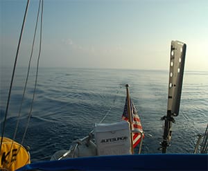
The PredictWind app provides weather and wind info. |
May the app be with you
There are still logistical considerations to keep in mind when deciding what and how to bring along all this digital knowledge. A few basic considerations include what type of hardware and operating systems (OS) you will use, how you will store all this material on those systems, and what you will need for backups in case of digital failure.
I am old-school enough to believe in carrying what I need to navigate without electronics. For me, that means having at least a small-scale (large area) paper chart of every region I plan to sail to, along with some paper guidebooks that usually include harbor chartlets for making landfall.
However, it is entirely possible to go 100 percent digital, and many voyagers do. Even if you are in the full-digital category, it is important to think about having backups and alternate equipment.
Tablets and smartphones are incredibly versatile tools on board, even if you never use them for actual navigational charting. Since they lack keyboards, they tend to be easier to carry around safely in addition to being more water resistant and easy to find waterproof cases for, and they are just physically more rugged than most laptops. Personally, I will always have a real laptop because I need the keyboard for serious typing, but many people actually prefer typing on the virtual keyboard of a tablet or smartphone. It’s also easier to deal with a touch screen in the cockpit.
 |
|
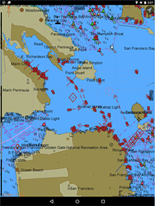
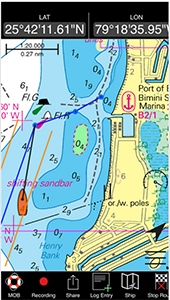
The Navionics app running one of the company’s charts. |
|
John Kettlewell |
A tape measure of sorts is still needed with your tablet and smartphone. Get out your mental “tape” and think about how many gigabytes you will need in order to bring along the equivalent of those 300 pounds of books and more. With phones and tablets there is a simple rule: the more the better. You will regret skimping on storage when you are trying to download a big new cruising guide, or a new movie to keep the kids entertained! Buy a tablet or smartphone with the biggest capacity you can, and you will be happier in the long run.
Navigation apps
There are many options when it comes to tablet and smartphone navigation apps. At the risk of raising someone’s blood pressure, typically you will find the best selection of the best apps in the Apple world. The simple reason for this is that developers tend to make more money selling iOS products than they do Android products. However, many developers make products for both operating systems. If you want to be certain that you will have access to the latest and greatest apps, go Apple; however, Android lovers can certainly benefit from smartphone and tablet offerings.
One issue to keep in mind is that, in general, it is easier to keep up to date with the iOS operating system, while Android devices do not always arrive with the latest operating system, even when brand new. For this reason, my advice is to purchase the latest/greatest devices you can afford, and choose major brands that are likely to remain in business and will continue to provide updates. For good business reasons, apps tend to be geared toward whatever is the latest version of the OS.
 |
|
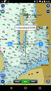
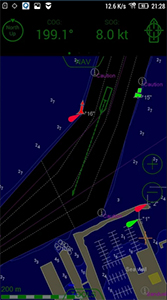
A screenshot from the iNavX charting smartphone app. |
Navionics (navionics.com/usa) has tablet and phone apps that give you nearly the full functionality of chartplotting systems. With a large enough tablet, many find these apps work even better than a dedicated chartplotter, though obviously you have to come up with a way to keep the device charged up and protected from the weather. The Navionics Boating app allows you to access worldwide nautical chart packages that have one-year subscriptions for various prices depending on the region, with the option to update the charts after a year for a reduced price. However, you don’t lose everything when the initial year expires, which could be bad when on passage! You retain the ability to use the charts you downloaded along with many other features.
One great feature on the Navionics app is that you can choose to only download charts for a selected area, saving some of those critical gigabytes of space on your phone or tablet. It is also very easy to switch between different units of measurement, meaning it is much easier to coordinate what you are seeing on the app with what you are seeing in the guidebook or on the paper chart. Anyone who has had to mentally convert between feet, fathoms and meters while juggling various navigation sources can appreciate having every unit at your fingertips. By simply tapping on the chart on my Android phone, I get a pop-up message that lets me know the depth and units used at that particular spot.
Other Navionics features include links to weather sources and even wind information. The crosshairs can be moved over a particular navigation aid to get the characteristics and number of the buoy or light, keeping that written information from cluttering the chart view.
C-Map offers their Plan2Nav app for both iOS and Android. One feature of this app is that the iOS version links to compatible Furuno/Standard Horizon plotters, giving you an additional remote display on board. The apps include free global weather reports and information from crowd-sourced cruising information platform Active Captain on Android devices (lightmarine.c-map.com).
 |
|
The app from GLEAW offers a unique way to describe positions on the globe. |
A mainstay of MacOS electronic charting is GPSNavX, which has long offered a charting program for use on Macs. The company also offers an app-based charting product called iNavX. This app makes use of the company’s long experience with its laptop-based product and can access a wide range of charts from official high-resolution NOAA RNC raster charts to Navionics to NV Charts to Soltenick and more. The app also allows you to request and display grib weather files as well.
A newer company, GPS Nautical Charts, offers worldwide charting apps for the main players, iOS and Android, and they even have options for Blackberry and Windows. One of their features is voice navigation, similar to what many are used to in automobile navigation. Since the size and cost of these apps are relatively modest, cruisers may want to have more than one brand depending on which one offers charts or better coverage in the areas you are headed (gpsnauticalcharts.com).
One word of caution with every charting app: It would be easy to assume that you are getting every chart available for a particular region, which is not always the case. It is prudent to check beforehand to see if you will need to fill in with a paper chart or two, or possibly a guidebook with chartlets. Frequently I find that the latest versions of nautical charts, which are typically the ones you find in the apps, are missing information that was formerly on older paper charts. For example, on a seldom-visited island in the Caribbean, I noted that the digital chart does not clearly show the large pier/breakwater that defines the poorly protected anchorage — a feature previously shown on older charts. That type of information may still be available in cruising guides, which are essential supplements to charts.
Transas iSailor is another app that also offers worldwide charts. One feature of interest is the “Sailing Guides” available in some areas when using the iOS version of the app. These guides are annual subscriptions for information on marinas and anchorages (www.isailor.us).
 |
|
The Transas iSailor app in night mode. |
SEAiq is an interesting product designed for use by professional mariners, but there are versions for recreational use. The app allows you to download and utilize your own nautical charts in standard, S-57, S-63, Inland ENC and BSB/KAP formats. This could be very useful for boaters utilizing a laptop charting program like OpenCPN (opencpn.org/index.html). You could utilize many of the same charts on your laptop, iPad or Android phone (seaiq.com).
For those who have been using the open-source charting software OpenCPN on their PC or Mac for many years, there is now an OpenCPN Android app that, similar to SEAiq, allows the use of charts in standard formats. In my experience, OpenCPN is a viable charting system for world cruisers on a budget, though it is not as slick or as full-featured as some of the proprietary commercial versions. It does allow for the trading of charts and the purchase of digital charts in many formats, which provides lots of options for obtaining information almost everywhere in the world. At the very least, it makes a good backup/alternative system to have on board since it runs on the PCs you are likely to have on your vessel.
There are many other contenders in app charting. There’s even an OpenSeaMap app in the iTunes store, along with an Android app called just SeaMap. Both are based on OpenSeaMap data, which is part of the OpenStreetMap project, and are worth checking out (here).
Another new app that takes its own approach to charting using an eight-figure location code instead of lat/long is a system called Globally Linked Earth and Web (GLEAW). The GLEAW system claims a higher degree of accuracy than lat/long and is reportedly a great tool when repeatability is desired. Capturing a GLEAW code when at a remote anchorage, for example, allows you to return to that spot with more confidence (www.gleaw.com).
 |
|
The NV Charts smartphone app. |
Weather or not
Weather apps are numerous and also compete closely on features and quality. The utilization of grib files for offshore weather forecasting is popular, and there are many apps that can assist with this. Before you jump onto the grib bandwagon, I highly recommend checking out the great information at The Weather Window website (weather.mailasail.com). The site is sponsored by MailASail, which provides a fantastic free service that will email worldwide weather reports to you. These emails are designed to be small in size so they utilize very little bandwidth and can be downloaded via satellite phone when offshore. Grib information is also available. MailASail’s email compression service called “teleport-weather” is worth considering as a way to send and receive email, weather information and more while out cruising.
One Android app, SailGrib, is approved by Iridium for use with their satellite phone system, making for a convenient way to get weather information offshore. It is also compatible with Chromebooks, which may be of interest to some. Atlases of currents are included along with tidal info, weather info, weather routing and nautical charts (www.sailgrib.com).
PredictWind is an excellent grib-based weather app (and winner of the ON 2015 Chuck Husick Marine Technology Award). The company’s Offshore App is designed for those who have to download the grib information over an SSB or satellite connection. PredictWind also has iOS and Android apps, as well as versions for laptops (www.predictwind.com/apps/).
There are many other contenders. Go to your favorite app store and searching for terms like “grib” and “weather” to see options.
 |
|
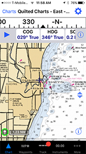
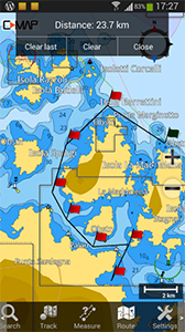
The CMap app showing a route. |
Guides and more guides
Replacing cruising guides with digital versions is becoming the norm in much of the world. Some of the newer and more useful-looking contenders include the popular Caribbean guides available from Cruising Guide Publications. You can view 10-page samples of each guide to decide if it is what you need, and then download the full guide for using it offline. This is a great way to have the latest guidebooks on board (www.cruisingguides.com).
Some lesser-known parts of the world have guide apps too. For example, in the iTunes store you can find the Sail Fiji Guide and the Sail Tonga Cruising Guide from the New Zealand-based Island Cruising Association (www.islandcruising.co.nz).
Another great way to get many guides is via the Kindle app available on most devices. You can download and use full versions of many useful books, like the Pacific Crossing Guide and World Cruising Routes. Those two alone probably weigh more than five pounds. Save your boat’s payload and sail faster over the horizon!
The app story is expanding rapidly and you will find many excellent products not mentioned in this article. Just be sure that you don’t find yourself depending on any single electronic gadget for important voyaging info, especially for navigation.
John J. Kettlewell is the author of The Intracoastal Waterway Chartbook: Norfolk, Virginia to Miami, Florida.