
Egersund, Norway – C-MAP®, a leader in digital marine cartography and cloud-based mapping, announced today the launch of new high-detail C-MAP DISCOVER and C-MAP REVEAL charts for Lowrance®, Simrad® and B&G® chartplotters.
The DISCOVER and REVEAL charts include new features like Custom Depth Shading, Shaded Relief for inland waters, subscription-free Easy Routing and more. The charts replace Insight PRO, Lake Insight HD, Precision Contour HD, MAX-N and MAX-N+ charts in the C-MAP line-up, greatly simplifying its chart portfolio.
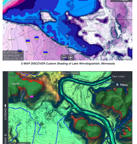
C-MAP DISCOVER – MAKE THE MOST OF TIME ON THE WATER
Whether cruising, fishing or sailing, the entry-level C-MAP DISCOVER charts have all the core features needed to make the most of time spent on the water and include coverage for the U.S. and Canada on one card. DISCOVER charts offer full-featured Vector Charts along with the best of C-MAP High-Resolution Bathymetry, including integrated Genesis® social map data.
The charts also feature Custom Depth Shading, delivering the highest level of information from underwater pinnacles and ledges to ditches and canyons. Users can set a clear safety depth, or create their own custom shading – a popular feature for fishing. The Tides & Currents feature provides projections of water level and direction of tides to help plan a day out cruising, fishing or sailing. Subscription-free Easy Routing™ automatically plots the shortest, safest route based on chart data and personalized vessel information.
Key Features for C-MAP DISCOVER
Full-Featured Vector Charts
High-Resolution Bathymetry
1-foot contours on 15,000+ U.S. Lakes, 9,400+ Canadian Lakes
Custom Depth Shading
Subscription-Free Easy Routing
Tides & Currents
Detailed Marina Port Plans
Harbor & Approach Details
Online Updates – including 12 months of free online updates
Compatible with Lowrance, Simrad and B&G Chartplotters
C-MAP REVEAL – THE GAME CHANGER
C-MAP REVEAL charts include all the attributes of DISCOVER charts, plus other premium chart features highlighted by seafloor and inland Shaded Relief. With Shaded Relief, users can view the world like never before with 3D-rendered land and underwater elevation, including areas of Ultra-High-Resolution Bathymetric imagery – a game-changer for anglers and divers.
C-MAP REVEAL also offers Dynamic Raster Charts, bringing a traditional paper chart look and feel; and Aerial Photography, providing an additional level of detail with thousands of photos of marinas, harbors, inlets and other notable navigational features. REVEAL’s Satellite Overlay delivers real-world reference and enhances situational awareness for coastal navigation. C-MAP REVEAL charts are available on REVEAL Lake cards – featuring Shaded Relief, plus 1-foot contours on more than 15,000 U.S. lakes and over 9,400 lakes in Canada – as well as REVEAL Coastal cards, which include the popular seafloor shaded relief views of the bottom.
“With REVEAL, boaters get extra features, including Shaded Relief, everywhere, coastal and inland,” said Max Cecchini, executive vice president, C-MAP. “Previously, that view was only available in our local products, in very select coastal areas. It was our customers who called this ‘game-changing,’ and we’re thrilled to be changing the game for all boaters by making this view available globally.”
Key Features for C-MAP REVEAL
Shaded Relief for inland, coastal and offshore waters
Full-Featured Vector Charts
High-Res Bathymetry
1-foot contours on 15,000+ U.S. Lakes, 9.400+ Canadian Lakes
Custom Depth Shading
Dynamic Raster Charts
Subscription-Free Easy Routing
Aerial Photography
Satellite Overlay
Tides & Currents
Detailed Marina Port Plans
Harbor & Approach Details
Online Updates – including 12 months of free online updates
Compatible with Lowrance, Simrad and B&G Chartplotters
By moving from a complex range of MAX-N and MAX-N+ charts to a simpler C-MAP DISCOVER and REVEAL chart line-up, C-MAP has made it easier for consumers to select a chart that fits their needs.
“This is a really important evolution for C-MAP,” continued Cecchini. “We spent a lot of time listening to our customers and after significant feedback, we decided to streamline our offerings. We’ve developed a simple, two-tier product line which brings the strongest data to all products, including entry-level DISCOVER charts.”
Now available, C-MAP DISCOVER and REVEAL charts are priced at $124.99USD and $149.99 – $249.99USD, respectively.
Visit www.c-map.com/chartexplorer to see a fully interactive viewer of C-MAP Shaded Relief. For more information, visit www.c-map.com.