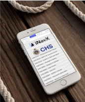
(SAN FRANCISCO) — iNavX, a leading marine navigation app, now provides access to CHS charts from the Canadian Hydrographic Service. These comprehensive digital charts provide exceptional detail when navigating in Canadian waters.
iNavX is the only marine navigation app to offer a full suite of worldwide charts from multiple chart providers that include NOAA raster charts, Navionics vector charts, Blue Latitude, Explorer Bahamas, Waterway Guide, Delius Klasing, and now better coverage than ever with the inclusion of CHS charts.
iNavX transforms popular phones and tablets into full functioning, handheld chartplotters. Sophisticated navigation functions can be used anywhere in an easy to use app. Location, heading, speed, COG, waypoints, routes and other navigation functions are attractively displayed on the device. Advanced features include high-resolution weather overlays and AIS data that are easily activated within the app. Access to worldwide charts from leading chart providers in iNavX and its full suite of MFD features lets boaters navigate safely and effectively on any boat anywhere in the world.
Planning trips and setting routes can be done remotely, alleviating the need for boaters to access their vessel and enter coordinates into sometimes cumbersome onboard plotters. Multiple devices can be accessed allowing the user to pull up their iNavX navigation functions and full suite of charts on their smart phones as well as tablets. iNavX is fully compatible with both iOS and Android devices and is available as a download from the Apple App Store or Google Play Store.
For more information, visit www.iNavX.com.

