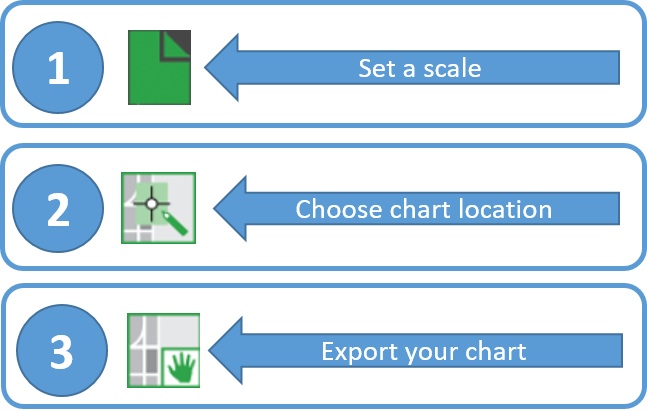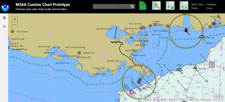
A new prototype online tool from NOAA allows you to build your own ENC vector chart. It then constructs a georeferenced PDF (geoPDF) file that you can view, download and print. In the final operational version of the application, chart notes and other margin notes will be placed at the bottom, below the chart neatline, similar to USGS topographic (US Topo) maps. According to NOAA, "Once the functionality of this prototype is fully developed, NOAA Custom Chart will be an easy way for boaters to create a paper or digital back-up for the electronic chart system or other GPS-enabled chart display that they are using on board. There are several options for customizing the appearance of the chart data. The prototype creates charts with either the “traditional” or “simplified” symbology of the Electronic Chart Display and Information Systems (ECDIS) used by professional mariners. Future versions of NOAA Custom Chart will add a full paper chart symbology option."