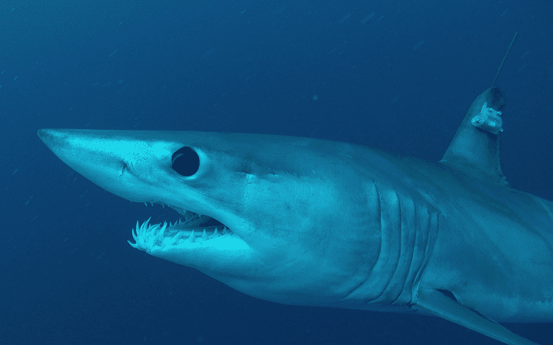
Satellite navigation is now so widespread that even sharks are adopting it. In March a group of researchers and volunteers from the Guy Harvey Research Institute at Nova Southeastern University tagged shortfin mako sharks off Isla Mujeres, Mexico. The satellite nav capability wasn't for the sharks to navigate, of course, but for researchers to track the movements and migration patterns of these sharks, which are experiencing population declines due to fishing pressure. Makos are sought for their fins and meat.
A shortfin mako that was tagged last year off New Zealand in another tagging effort shows that these animals cover large distances in their movements through the ocean. Tracking data showed that the New Zealand shark covered almost 9,500 miles during the course of ten months — true ocean voyagers!
"We hope to replicate the tremendous success of our New Zealand research in the Atlantic," said Dr. Guy Harvey. "Now we have a new group of Atlantic makos to follow which should reveal much new information on their seasonal movements in our part of the world, including the route that they take and distances traveled."
The sharks were tagged with tracking devices called SPOT Tags, manufactured by a company called Wildlife Computers.
Guy Harvey Leads Isla Mujeres Expedition – Mako Sharks from George Schellenger on Vimeo.