There’s a dirty secret about the Coconut Milk Run. Oh, all the hype is true: day after day of downwind running, pristine lagoons encircled by palm-strewn motus, the fascinating history of Polynesian culture, and beautiful, welcoming peoples. Yes, it’s just like in the guide books.
But first you have to get there. Coming from the Caribbean, via the Panama Canal, there’s the small matter of 1,000 miles or so of uphill work to be done getting to the Galápagos Islands.
If it was simply a matter of close reaching for a week or 10 days, it would be one thing (and a short article). But the reality is much more complicated than that and as a result each voyager’s experience tends to be unique. An informal survey of the dozen or so boats here in Wreck Bay, San Cristóbal, indicates passage times from less than eight days to more than twice that, maximum winds from 25 knots to 50 knots, from 12 to 72 hours of motoring, and emergency stops along the Colombian or Ecuadorian coasts.
The big picture
The Pacific side of the Panama Canal at Balboa, Panama, lies at about 8° N, 79° W; the Galápagos, at 1° S, 90° W — a rhumb line distance of about 850 nm (ignoring inconvenient shoals and capes).
The Intertropical Convergence Zone (ITCZ) with its attendant squalls and convection must generally be crossed somewhere between Balboa and 3° N. Tropical waves that survive crossing the mainland also bring unsettled weather and gusty winds as they traverse the area east to west. Convection rises from the land most days and storm cells drift out to sea all along the coast.
North of the ITCZ, north or northwest winds may be enjoyed in the gulf and slightly south. Once out of the ITCZ on the south side, trade winds from the Southern Hemisphere begin to be felt. Although originating as southeasterly winds, the trades bend to the right as they cross the equator becoming southerly, then southwesterly, and even west-southwesterly farther to the north.
A south-setting current is felt in the Gulf of Panama and to the south to about 6° N where it becomes intermittent. Offshore, at about 2° N, the beginnings of the South Equatorial Current are felt, setting to the west or west-northwest.
First step
Upon leaving Balboa, many boats stop for a night or two at Taboga Island, eight miles to the southwest. The anchorage there offers good holding though only moderate protection from the daily northerly winds. Nevertheless, there’s fresh air and clean water away from the canal traffic. Voyagers weaned in the Caribbean especially will appreciate the tall seawalls fronting the town and the huge rocky foreshore. No eight-inch tides here; 15 feet is more the norm.
Lying about 45 nm to the southeast, the Las Perlas island group is a great place to do final preparation for the crossing to the Galápagos while waiting for the opportune weather window. The islands are a cruising ground in their own right with quiet anchorages, white sand beaches, and sparsely populated islands. Don’t plan on refueling or reprovisioning here, however.
Strong tidal currents sweep between the islands here. The waters are rich in nutrients, bringing diverse animal life. In our short stay we saw dolphins, whales, flying spotted eagle rays, and cruising manta rays.
The waters are also rich in flotsam — natural and man-made. Just south of the Perlas on our first circumnavigation, Gryphon encountered a tree as big as she, damaging our speed log and rudder in the event. Man-made trash floats in large current-driven lines and the islands’ beaches often end up being huge filters for this unfortunate feature.
Still, the islands are attractive and interesting. Our favorite anchorage was a small beach near Don Bernardo on Isla Pedro González. The holding was excellent in sand and there was great protection from the southerly swells and the southeasterlies that developed most days. There would also have been good protection from northerlies, though at the time of year we were there (May) the northerlies did not reach the Las Perlas as strongly as they might earlier in the year. Ripe, fresh mangoes dropped from the trees just behind the beach and we wandered the jungle along dirt tracks portending future development.
The great thing about hanging in the Las Perlas is that you can enjoy cruising while simultaneously waiting for your weather window to go south. When conditions are right, heave up the anchor and you’re off.
Choosing the weather
To my mind, there are two important weather features to consider in timing your Panama departure: the position of the ITCZ and the forecast of tropical waves.
The ITCZ is a permanent feature of the eastern Pacific, though it is anything but stationary. In the northern winter and spring — when most voyaging boats will make this passage — the ITCZ is usually present in these latitudes. In the northern summer and fall, it is likely to be north of the area.
Even when the ITCZ is present, however, it is constantly moving and changing in intensity. During the 10 days we tracked it, it varied from 3° N to 10° N and was on occasion completely absent from our area of interest. It can be anywhere from 50 to 300 miles wide, though 150 miles is typical.
North of the ITCZ, the prevailing winds are generally northerly; south of it, southerly. Obviously if it is to the south when you leave Panama, you’ll have northerly winds for the first period of time. Tempting as this sounds, the cost you pay is in having to cross the ITCZ. In the ITCZ itself, you are likely to find light and variable winds interspersed with moderate to strong cells of convection. Wind shifts of 180 are common and rain can be so thick as to make the bow disappear. Although you can often thread your way around scattered moderate convection, encountering a pocket of strong convection can be a harrowing experience. Still, if the ITCZ activity is light and not too wide, you can motor through it in a day or less.
Alternatively, if the ITCZ is north of the area or absent altogether from this longitude, you can avoid encountering the worst of the convection and squall activity completely. This is what we found on our recent crossing and it was a delight to enjoy moonlight instead of lightning.
Tropical waves are north-south running lines of low pressure that move from east to west across the area. Anyone who has cruised in the Caribbean in the summer will recognize them. Tropical waves bring unsettled weather, heavy overcast, and squally convection. The effects of a strong wave can be felt up to 300 miles to the east and/or west of the feature.
Depending on the season, waves may be encountered with some regularity every few days, irregularly, or not at all. It is necessary to watch the forecasts to determine what (if any) pattern is present.
Opening the weather window
There are several good weather products available from the National Weather Service’s Tropical Prediction Center that can be used to track the ITCZ and to predict and track tropical waves.
High seas forecast for the Eastern Pacific from the equator to 30° N: Broadcast by NMC (Pt. Reyes, Calif.) or available for download from saildocs.com. Issued every six hours, this text forecast covers a vast area but, more importantly, it describes the position of the ITCZ and any areas of moderate to strong convection associated with it. It also describes the position of any tropical waves and their associated convection.
CONVECTION VALID AS OF 0115 UTC THU JUN 03…
TROUGH 12N116W TO 1012 MB LOW PRES NEAR 10N118W TO 08N122W.
SCATTERED MODERATE WITHIN 90 NM N AND 75 NM S OF TROUGH AND BETWEEN 150 NM AND 240 NM SE QUADRANT OF LOW.
TROPICAL WAVE FROM 03N84W TO 09N82W. SCATTERED MODERATE ISOLATED STRONG WITHIN 300 NM W OF WAVE N OF 08N. SCATTERED MODERATE WITHIN 180 NM E OF WAVE N OF 06N.
INTERTROPICAL CONVERGENCE ZONE…09N94W TO 11N94W TO 09N109W TO 10N120W TO 06N140W. SCATTERED MODERATE BETWEEN 75 NM AND 210 NM S OF AXIS BETWEEN 87W AND 95W…WITHIN 90 NM S AND 45 NM N OF AXIS W OF 136W…AND WITHIN 150 NM N OF AXIS BETWEEN 114W AND 116W.
– Excerpted from FZPN03, 0430 UTC THU June 3, 2010
Tropical surface analysis — western half: Weatherfax broadcast by NMG (New Orleans, La.), 0005/0605/1205/1805 UTC. Also issued every six hours, this analysis graphically shows the position of the ITCZ and any tropical waves or other features. From this graphic you can see the presence of any tropical waves over the continent.
24-hour, 48-hour, 72-hour surface forecasts: Weatherfax broadcast by NMG (New Orleans, La.), starting 0105/0705/1305/1905 UTC. Issued every 12 hours, these weather charts show the progression of tropical waves over the area. They do not indicate the strength of the waves nor any prediction for the ITCZ. Nevertheless, they are useful in timing the passage of tropical waves. The charts are very uncluttered making them valuable when weatherfax reception is poor.
Sea state analysis and wind/wave forecasts: Weatherfax broadcast by NMG (New Orleans, La.), starting 0035/0635/1235/1835 UTC. These charts are of less use within the area of interest. Since the synoptic winds are generally light with widely spaced isobars (see above), there is little information to be gained from them. The one useful feature of these charts is to give advance warning of a large southerly swell; apropos for selecting anchorages in Las Perlas, though in truth of little consequence on passage.
While the weather charts and forecasts listed above indicate the day-to-day position of the ITCZ and tropical waves, they do little for tracking the movements of these features. For this, we use a simple sheet of graph paper, marking the latitudes from 0° to 9° N and the longitudes from 77° W to 86° W, and roughly sketching the position of the coasts of Panama, Colombia, and Ecuador. Then with the receipt of each day’s forecast, we mark (in different colors daily) the location of the axis of the ITCZ and any tropical waves, along with any associated convection activity.
The simple chart we make, coupled with the current suite of surface forecasts, enables us to see the daily movement of the ITCZ and waves along with the expected location of the waves. Based primarily on this information — and looking out the galley port each morning — we chose our departure to coincide with a strong northerly shift in the ITCZ and the absence of predicted waves.
Underway routing
One’s choice of route is generally dominated by trying to find favorable winds for laying the Galápagos. Once south of the ITCZ, WSW winds — generally light — will be found. The farther south one goes, the more these winds will back and settle into a moderate breeze. Eventually, by the time the equator is reached, the wind will be southerly. The farther you are from the coast, the truer this generalization becomes. GRIB files containing data from the most recent run of the Global Forecast System (GFS) model are the best source of local wind forecasts and route planning. (The GFS model is good for predicting the general state and trend of the winds in this area, although it is not particularly good at predicting the conditions associated with tropical features since the coarse nature of the model fails to correctly ‘see’ small features.)
The general consensus (Jimmy Cornell, Royal Cruising Club Pilotage Foundation, and others) is that considerable southing should be made before turning west towards the Galápagos. There is agreement that one should stand well off Cabo Mala upon leaving the Gulf of Panama, and to continue working south keeping to the east of Isla Malpelo. In this way, one spends the least amount of time in the area dominated by the ITCZ and one gains a southerly boost from the eastern extreme of the Equatorial Counter Current as it encounters the coast and bends south. (The middle track on the earlier chartlet shows the route recommended by the RCC Pilotage Foundation’s Pacific Crossing Guide.)
Just how close to the coast and how far south to sail before turning west becomes the strategic decision of the trip.
Some weather routers have suggested staying closer to the coast and carrying south as far as 1° N or 2° N before turning. For the voyagers here in Wreck Bay who chose that path, it seems that they encountered considerably more areas of heavy rain, squally conditions, and strong convection. In part this may have been due to simple timing, but a perusal of the forecasts shows that convection is often found close to the coast of Colombia even when the offshore areas are clear. (The eastern track on the chartlet shows a coastal route as favored by some.)
For us, we chose to make as much southing as possible, but without giving up any westing; drawing an imaginary line straight south from the Las Perlas, we would not cross to the east of that line. Since we were already south of the ITCZ, we started with WSW winds; winds that would occasionally back to SW or even S in showers. We would sail south whenever possible, tacking to avoid more than just a few degrees of easting. By sailing close to the wind or motoring when it was exceptionally light, we were able to make about 120-140 nm per day, almost due south.
In day four at about 2.5° N latitude, the wind finally backed sufficiently for us to tack onto port — the tack that we carried for the next three-and-a-half days. Starting from about 2.5° N, 80° W, we tried to lay the Galápagos as best we could. At first we headed west, but as the wind slowly, slowly backed we were able to point directly at the islands.
Around 1.5° N, the South Equatorial Current started to be felt and we watched our speed over ground jump from 6 knots to an average of 8.5 knots. At times we were doing 11 knots according to the GPS — in about 12 knots of wind and with very kind seas. Magic.
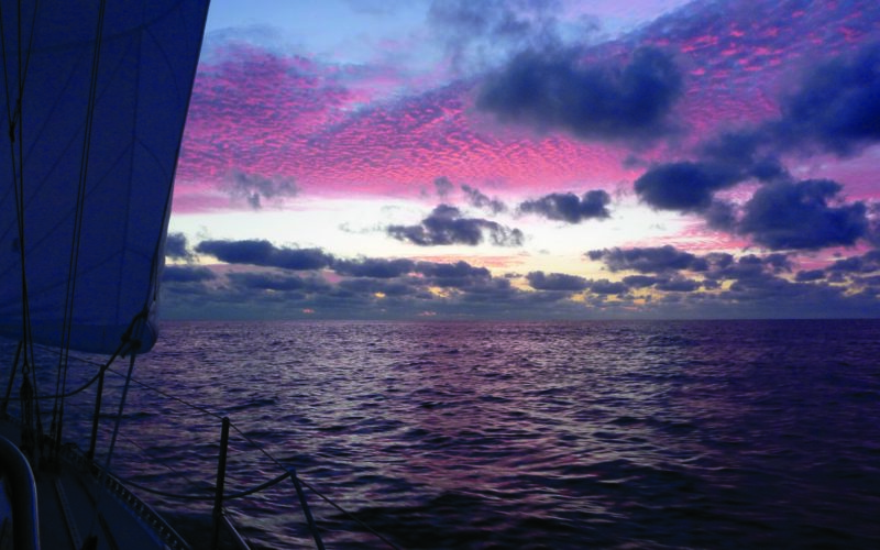
We slowed down a trifle our last night out, timing our landfall at San Cristóbal to coincide with the sunrise. It was almost impossible to go slower than 4 knots, but in the end the wind failed completely and we motored in to Wreck Bay on a glassy sea, seven days and 21 hours anchor-to-anchor from Isla Pedro González — an improvement of more than 24 hours over our previous trip.
Raine & Jeff Williams regurgitated the anchor five years after their first circumnavigation ended. They are currently headed west aboard their J/40 Gryphon. Their website is at www.sailblogs.com/member/j40gryphon.